Benchmark Problem "Stereo or trinocular SLAM - Bovisa_2008-10-04"
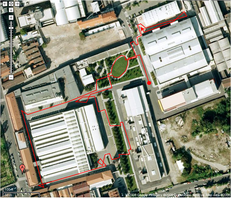
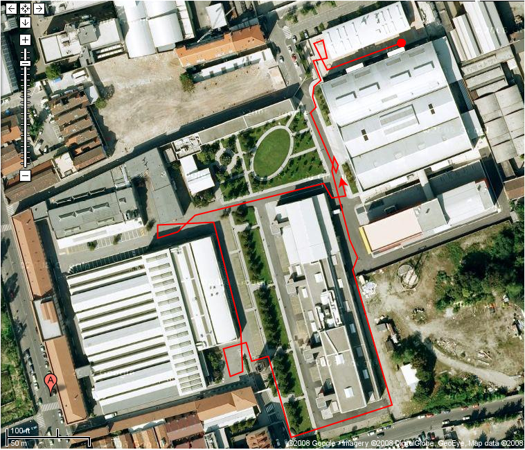 Perform a map building activity with SLAM (online), using the sensor data files provided below. Such files come from the Bovisa_2008-10-04 data-collection session; they include output and calibration information associated to B/W trinocular (including stereo) camera system, IMU, odometry, and the ground truth for the specified session.
Please note that the Bovisa_2008-10-04 session also includes other data files, not used for this Benchmark Problem.
This BP belongs to the very first batch of problems published by Rawseeds; other BPs will follow.
Media
Images
Attached Files
- List of corner positions for the Bovisa location (extracted from the executive drawings) - _Bovisa-Corners.tar.torrent
- Set #02 of sensor positions on the robot - _SensorPositions_02.tar.torrent
- Set #01 of file formats - _FileFormats_01.tar.torrent
- CAD drawings of the Bovisa location - _Drawings_01.dxf.bz2.torrent
- Results of Calibration 02. - _Calibration_02-Results.tar.torrent
- Images from the top SVS camera used for Calibration 02. Checkerboard has 100mm x 100mm squares. - _Calibration_02-Used_for_calibration-SVS_T.tar.bz2.torrent
- Images from the right SVS camera used for Calibration 02. Checkerboard has 100mm x 100mm squares. - _Calibration_02-Used_for_calibration-SVS_R.tar.bz2.torrent
- Images from the left SVS camera used for Calibration 02. Checkerboard has 100mm x 100mm squares. - _Calibration_02-Used_for_calibration-SVS_L.tar.bz2.torrent
- Set of images generated by the top SVS camera from which the images used for Calibration 02 have been selected. Checkerboard has 100mm x 100mm squares. - _Calibration_02-All_images-SVS_T.tar.bz2.torrent
- Set of images generated by the right SVS camera from which the images used for Calibration 02 have been selected. Checkerboard has 100mm x 100mm squares. - _Calibration_02-All_images-SVS_R.tar.bz2.torrent
- Set of images generated by the left SVS camera from which the images used for Calibration 02 have been selected. Checkerboard has 100mm x 100mm squares. - _Calibration_02-All_images-SVS_L.tar.bz2.torrent
- Ground truth (trajectory data) from RTK-GPS - Bovisa_2008-10-04-GPS.csv.bz2.torrent
- Top SVS camera: data - Bovisa_2008-10-04-SVS_T.tar.torrent
- Right SVS camera: data - Bovisa_2008-10-04-SVS_R.tar.torrent
- Left SVS camera: data - Bovisa_2008-10-04-SVS_L.tar.torrent
- Odometry: data - Bovisa_2008-10-04-ODOMETRY_XYT.csv.bz2.torrent
- Set of list files associated to video streams. For each camera it includes: - a .csv file with the timestamps of all the frames in the data stream; - a .lst file with the filenames of all the frames in the data stream. - Bovisa_2008-10-04-LISTS.tar.torrent
- IMU: data - Bovisa_2008-10-04-IMU_STRETCHED.csv.bz2.torrent
- Matlab scripts and data to automatically compute some of the evaluation metrics, given the trajectory data output by a SLAM algorithm. Includes an extended ground truth covering the whole path of the robot, obtained by manual scan matching performed on the data from onboard LRFs (indoor datasets only). - _Rawseeds_Metrics_Computation_Toolkit
Evaluation Methodologies
The provided solutions will be evaluated and scored with respect to the following evaluation methodologies:
- ATE compares the trajectory of a robot, as reconstructed by an algorithm using real sensor data as its input, to the actual trajectory (ground truth). ATE is a mandatory performance measure. Please ... - Absolute Trajectory Error
- ME compares the map of an environment, as reconstructed by an algorithm using real sensor data as its input, to the actual map of the location (ground truth). ME is a recommended performance measure. - Mapping Error
- RPE measures the accuracy of a SLAM result, as reconstructed by an algorithm using real sensor data as its input, by comparing the reconstructed relative transformations between nearby poses to the ac... - Relative Pose Error
- REC provides a basic estimate of how the running time of an algorithm (which uses real sensor data as its input) scales as the quantity of data available to be processed increases. REC is a mandatory... - Rough Estimate of Complexity
- SLE aims to evaluate the overall quality of a SLAM algorithm by actually using its output in a realistic application. The SLAM algorithm, fed with real sensor data from a robot, is used to build a map... - Self Localization Error